
Twelve walks in Dorset, from Old Harry Rocks to Hambledon Hill: distances, car parks and charges, dog rules and the storm closures, checked 26 October 2026.
Most people searching for a walk in Dorset end up on one of four: the mile out to Old Harry Rocks from Studland, the climb to Golden Cap, the highest point on the south coast, the path over the hill from Lulworth Cove to Durdle Door, and the ramparts of Maiden Castle outside Dorchester. Below are those four and eight more, from Weymouth’s town-centre nature reserve to the hill forts above the Blackmore Vale. Every entry was checked against the landowner’s own pages on 26 October 2026, after the storm, and three of them carry closures or warnings.
We have not walked these routes for this guide, and nothing here is a recommendation of our own. Each entry sets out what the National Trust, Dorset Council, English Heritage, the RSPB, Forestry England or the Lulworth Estate publishes about the route: length, surface, parking and charges, toilets and dog rules. This guide covers the Dorset Council area; Bournemouth, Christchurch and Poole are not included.
Purbeck coast
Old Harry Rocks from Studland
The shortest way to the chalk stacks off Handfast Point is from the National Trust’s South Beach car park in Studland: about a mile each way, roughly 20 minutes, on a wide, mostly level grass and dirt path along the South West Coast Path. The Trust also lists a circular of about 3.5 miles, and the coast path carries on 4.8 miles to Swanage, with a bus back. When we checked on 20 October, South Beach car park charged £4 for two hours. Our Old Harry Rocks walk guide has the route, the Ballard Down loop and all the car parks. National Trust, Studland Bay.
Durlston Country Park, Swanage
Dorset Council’s country park on the headland south of Swanage has five waymarked trails, all starting and finishing at Durlston Castle, where the park says you can pick up a trail pack. Its access page gives the lengths. The Woodland Trail is about 1km on tarmac, woodchip and limestone, gently sloping with plenty of benches. The Clifftop Trail is 1km past the seabird colonies and the Great Globe, with “one very steep section”. The Wildlife Trail is 2km on grass with one steep hill and no seats, and the Victorian Trail is 5km into Swanage and back. There is also a tarmac path to Anvil Point Lighthouse. Two Tramper off-road buggies can be booked on 01929 424443. Parking is the only charge: £2.50 for an hour, £4 for two, £7.90 for five hours or more, paid on leaving (Durlston parking). The park and car parks open sunrise to sunset; the castle is open 10am to 4pm from 1 November. Dogs on a lead or under very close control; no cycling. Lighthouse Road, Swanage, BH19 2JL.
Lulworth Cove to Durdle Door
Durdle Door is about a mile west of Lulworth Cove along the South West Coast Path, over the shoulder of Hambury Tout. It is a stiff climb both ways on a wide but loose chalk path: allow at least half an hour each way, and wear trainers or boots. The Lulworth Estate owns the land and says the arch was formed when the sea broke through the Portland limestone around 10,000 years ago; there is no access to the beaches after 9pm or dusk. On the estate’s parking page on 26 October, Lulworth Cove car park was £9 for up to three hours and £17 for six; Durdle Door car park (BH20 5PU) was £15 for up to six hours. Our guides to Lulworth Cove, Durdle Door and Man O’War beach cover the beaches at each end.
West Dorset coast
Golden Cap, near Chideock
Golden Cap is 191 metres high, the highest point on the south coast of England. The National Trust says that on a clear day “you can see across Lyme Bay to Dartmoor”. The gentle way up is the signposted path from its Langdon Hill car park (nearest postcode DT6 6EP), and the Trust times the Langdon Hill woodland circuit at about 30 minutes. The full walk is the South West Coast Path Association’s 4.5-mile loop from Seatown over the summit and past the ruined St Gabriel’s Chapel, which it grades challenging. On 26 October the Trust warned of an active landslip near the coast path at Stonebarrow Hill, at the western end of the estate: avoid the area and follow the signs. Cattle are grazing on Stonebarrow, so dogs must be on a lead there. Toilets at the Old Radar Station on Stonebarrow open April to September and at October weekends. Our Golden Cap walk guide has the three routes step by step.
Weymouth and Dorchester
Radipole Lake, Weymouth
Radipole Lake is an RSPB reserve of 83 hectares of reedbed and lagoons, in the centre of Weymouth and designated a Site of Special Scientific Interest. The RSPB says bearded tits, kingfishers, otters and water voles live there. It has two signposted trails, “firm and generally flat”, surfaced with concrete or crushed stone, plus a crushed-stone path to a viewing screen at the north end with a raised, ramped platform. There is no RSPB car park: use Dorset Council’s pay and display Swannery car park next door, which has public toilets, including an accessible one, 120m from the Discovery Centre. Dogs on short leads are welcome on the designated dog-friendly trails. Radipole Lake Visitor Centre, Weymouth, DT4 7TZ.
Maiden Castle, Dorchester
English Heritage describes Maiden Castle as one of the largest and most complex Iron Age hillforts in Europe, the size of 50 football pitches, with ramparts begun about 2,400 years ago. It is free and open “any reasonable time during daylight hours”. There is a small car park at the fort that “can become busy at peak times”. The paths have been worn into the chalk, which English Heritage warns can be uneven and slippery, so wear sturdy footwear; the ramparts are not suitable for wheelchairs. The site is very exposed with no shelter. Sheep graze, so dogs must be on a lead. Barbecues and naked flames are banned. Maiden Castle Road, Dorchester, DT2 9PP.
Thorncombe Wood and Hardy’s Cottage, Higher Bockhampton
Thorncombe Wood is a Dorset Council local nature reserve of ancient woodland opening onto heath, east of Dorchester. The council says it holds a Roman road, Black Heath and Rushy Pond, and runs a free volunteer-led health walk there every Friday, 10am to 11am, meeting outside the visitor centre; no booking, dogs on a short lead. At the edge of the wood is Hardy’s Cottage, where Thomas Hardy was born in 1840; entry is £12 for an adult. On 26 October the National Trust said fallen trees had closed the woodland route to the cottage: use the bridleway behind the visitor centre instead, which it describes as unsurfaced, muddy and uneven, and pick up the map in the car park. Allow 15 to 20 minutes from the car park. Park in the council’s Thorncombe Wood car park (charges apply); satnav “Thorncombe Wood Car Park”, near DT2 8QJ.
The Cerne Giant, Cerne Abbas
The Cerne Giant is a 180ft figure cut into the chalk above Cerne Abbas, which the National Trust calls Britain’s largest chalk hill figure. Its archaeologists concluded in 2021 that it was probably first made in the late Saxon period. From the centre of the village it is “a gentle ¼ mile walk” along a signposted footpath to the viewing area, which has a flat tarmac car park, one accessible space and the best view of the figure. Access to the giant itself is restricted to stop erosion; the hillside around it is steep grass and chalk and very muddy after rain. Longer walks join the Wessex Ridgeway, a mile away. Open dawn to dusk; dogs on leads. The weekday-only 216 bus between Dorchester and Sherborne stops at the viewing area. Near DT2 7AL.
North Dorset
Hambledon Hill, Child Okeford
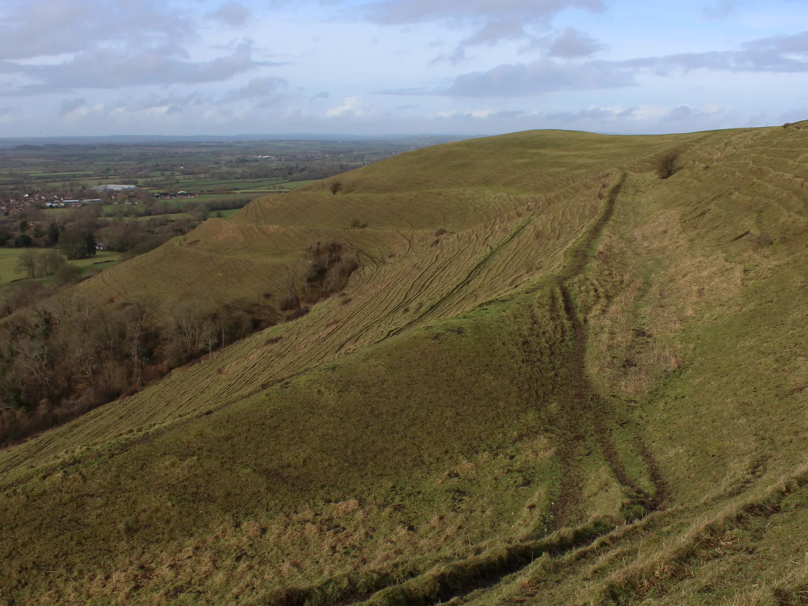
Hambledon Hill rises steeply to 190 metres above the Blackmore Vale and the River Stour. The National Trust calls it one of the best-preserved Iron Age hill forts in Britain, and it is a National Nature Reserve where 28 species of butterfly have been recorded, including Adonis blue and chalk-hill blue. Parking is limited: the Trust lists “a small unsigned roadside lay-by with parking space for four cars” south-east of Child Okeford, or you can park in the village and follow one of the footpaths up. The Stour Valley Way crosses the hill. The Trust does not list it as accessible for disabled visitors. Dorset Life’s walk notes say cattle graze the hill fort, so keep dogs on a lead. Near DT11 8HD.
Hod Hill, Stourpaine
Hod Hill, just south of Hambledon across the valley, is Dorset’s largest hill fort, according to the National Trust. It is unusual in having both Iron Age and Roman earthworks: of its five entrances, two are Iron Age, two Roman and one medieval, and inside are the hollows of round houses. The Trust’s directions: from the A350 beyond Stourpaine, turn towards Child Okeford, and the small Hod Hill car park is on the left after half a mile (grid reference ST853112). Stourpaine’s postcode, DT11 8TA, has no parking of its own. The North Dorset Trailway runs alongside, and buses between Blandford and Shaftesbury stop at Stourpaine. The two hills make a natural day’s walk together.
East Dorset: Wimborne and Ferndown
Kingston Lacy and Badbury Rings, near Wimborne
The National Trust’s Kingston Lacy estate covers 8,500 acres of parkland, woods, heath and water meadow. The woodland walks and parkland are part of a paid visit (£23 for an adult in 2026, free to members). On 26 October sections of the Woodland Trail were closed after storm damage, though the Trust said a 1.5-mile woodland route, the garden, café and shop were open. Dogs on a lead are welcome on the woodland walks and parkland, not in the formal garden or the house. The cheaper alternative on the same estate is Badbury Rings, an Iron Age hill fort, where non-members pay £1.60 an hour, £3.20 for up to four hours or £6.40 a day to park. Kingston Lacy, Wimborne Minster, BH21 4EA.
Moors Valley Country Park and Forest, Ashley Heath
Moors Valley is run jointly by Dorset Council and Forestry England, and its waymarked routes range from the Lookout Trail (1.3 miles) and the Play Trail (2.5 miles) to the Long Forest Walk (4.3 miles). The Lakes and Riverside Walk round Moors Lake is about three-quarters of a mile. Entry is free but parking is charged: in October half term, to 1 November, £5.70 for an hour and £17 for five hours or more. From 2 November weekdays drop to a flat £2.70 (parking charges). On 26 October the car park opened 8am to 6pm. The park asks visitors in school holidays to arrive before 10am or after 2pm, and closes the car park temporarily when it is full. Horton Road, Ashley Heath, BH24 2ET.
How we chose
These are the walks with the strongest public record, chosen to spread across the county: the National Trust’s coast and hill fort land, Dorset Council’s country parks and nature reserves, English Heritage’s largest Dorset monument, the RSPB’s reserve in Weymouth and the Lulworth Estate’s stretch of the Jurassic Coast. They are not ranked. Each one was checked on 26 October 2026 against the landowner’s own pages for distances, parking charges, dog rules and current notices; the National Trust’s notices change daily after storms, so look at the place’s page on the morning you go. Prices are the landowners’ published prices and can change. Look after a place that should be here, or spot something that has changed? Email newsdesk@dorsetpost.co.uk.
For more to do, see things to do in Dorset, what’s on in Dorset this month, Dorset’s dog-friendly beaches, Chesil Beach and parking in Dorset. For somewhere to eat afterwards, read our guides to Dorset pubs, Dorset cafes and Sunday roasts in Dorset.
Frequently asked questions
What is the easiest walk in Dorset?
The flattest routes on this list are Radipole Lake in Weymouth, where the RSPB says its two signposted trails are firm and generally flat, the Woodland Trail at Durlston Country Park, about 1km on tarmac, woodchip and limestone, and the Lakes and Riverside Walk at Moors Valley, about three-quarters of a mile. The shortest coast walk is the mile from Studland’s South Beach car park to Old Harry Rocks.
Are any Dorset walks closed after the storm?
On 26 October 2026 the National Trust said sections of the Woodland Trail at Kingston Lacy were closed after storm damage, and that fallen trees in Thorncombe Wood had closed the woodland route to Hardy’s Cottage, so walkers should use the bridleway. It also warned of an active landslip near the coast path at Stonebarrow Hill on the Golden Cap estate.
Which of these walks allow dogs?
All twelve allow dogs, but most ask for a lead: on Maiden Castle and Hambledon because of grazing animals, at the Cerne Giant, at Radipole Lake on the designated dog trails, and on Stonebarrow Hill while cattle are grazing. Durlston allows dogs on a lead or under very close control. At Kingston Lacy dogs are welcome on the woodland walks and parkland but not in the formal garden or the house.
Have your say